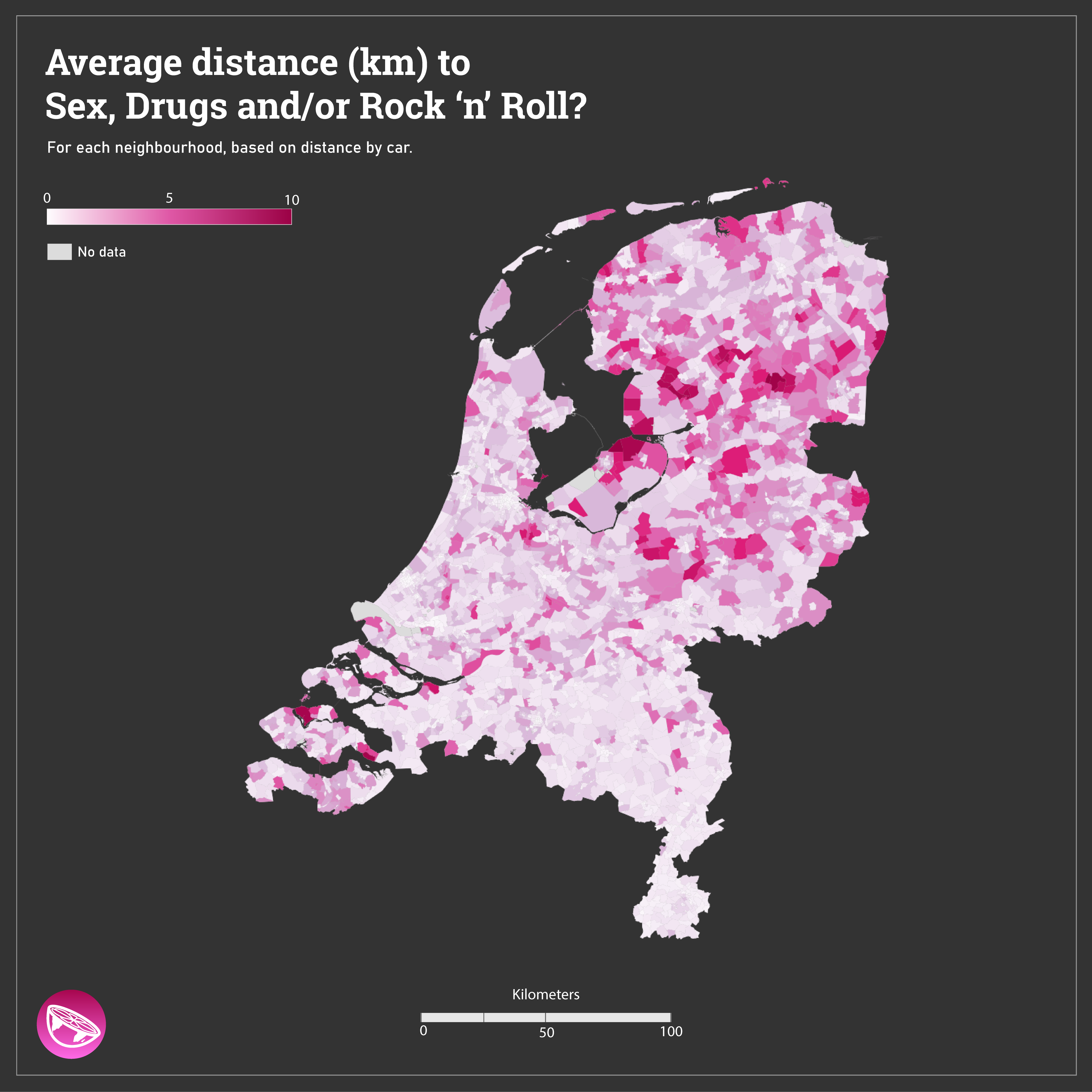
We found this rather interesting variable in the dataset of the Dutch Statistics Office: 'Average distance of all residents in an area to the nearest café, coffee house, cannabis retailer, disco, sex/night club or party center'. For each neighbourhood, based on distance by car in kilometers.
Data: Centraal Bureau voor Statistiek - Wijk en buurtkaart 2019
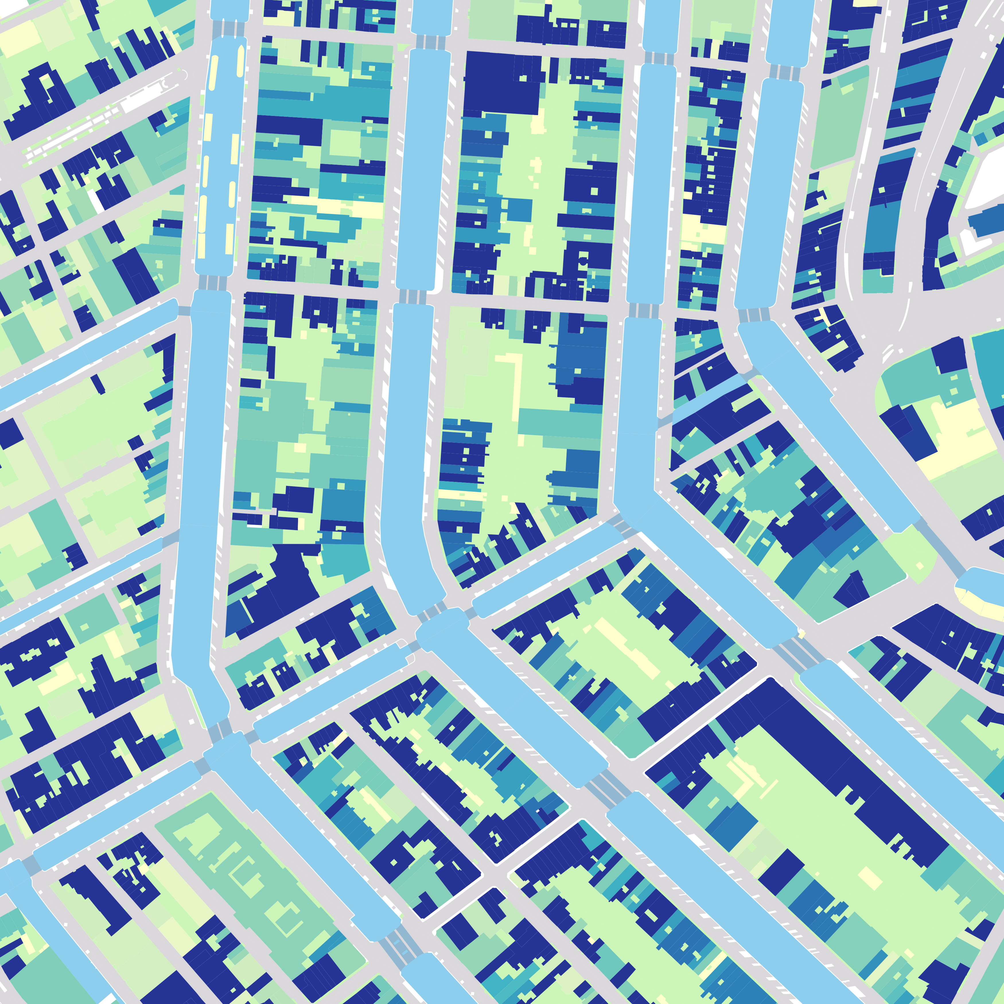
Year of construction of buildings in Amsterdam. We combined openstreetmap buildings with BAG addresses in Amsterdam. Which city should we visualize next?